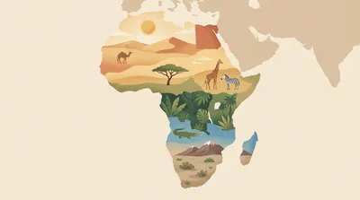
Africa
Explore Africa’s geography through quizzes on countries, capitals, landforms, and regional patterns. Practice locating places on the map, recognizing key physical features, and connecting climate and culture across the continent.
Quizzes

African coasts: gulfs, bays, and capes
Trace Africa’s shoreline through its best-known gulfs, bays, and capes—from the Mediterranean edge to the Cape of Good Hope. This mixed-difficulty quiz helps you connect coastal names to the correct countries, seas, and ocean basins. Pick your preferred question count and difficulty, then learn by repetition with no time pressure.
African climate zones and biomes
Explore Africa’s climate zones and biomes, from Sahara deserts to Congo rainforests and highland regions. This mixed-difficulty quiz helps you connect rainfall, temperature, vegetation, and location across the continent. Choose your preferred question count and difficulty, then answer each multiple-choice item at your own pace.
African lakes: rift, crater, and basin
Trace Africa’s great lakes by origin and setting—rift valleys, volcanic craters, and broad basins. You’ll identify where famous waters lie, what formed them, and which rivers connect them. Mixed difficulty keeps it welcoming for beginners while still testing map-savvy players.
What you'll find here
- Curated quizzes focused on Africa
- Difficulty spread from easy to hard
- Randomized questions with instant feedback
- Quizzes you can replay and compare on the leaderboard
Category FAQ
How many quizzes are available?
There are 3 quizzes with 353 questions total.
Do the Africa quizzes have a timer?
No. There is no timer, so you can answer at your own pace.
How are the questions formatted?
Each question is multiple-choice with 4 options.
What topics are covered in this Africa category?
Expect questions on countries, capitals, major landforms, rivers and lakes, and Africa’s main regions.
Are there different difficulty levels or quiz lengths?
Yes. The set includes quizzes that vary in length and difficulty, from broad basics to more detailed geography.
More to explore
What you’ll practice
These Africa quizzes focus on core map skills: countries and capitals, major rivers and lakes, deserts and mountain ranges, and broad regions such as North, West, East, Central, and Southern Africa.
You’ll also practice reading geographic patterns—how climate zones, coastlines, and elevation influence settlement, languages, and trade routes.
How the quizzes work
Each question has 4 answer options and there’s no timer, so you can focus on accuracy and learning. Quiz difficulty and length vary across the set, letting you start with broad basics and move toward more detailed place knowledge.
- Identify African countries and match them to capitals
- Place key physical features like the Sahara, Nile, and Great Rift Valley
- Compare regions and their climate and vegetation zones
- Recognize island nations and important coastal locations
- Review borders and neighbors to improve map recall
Quick context and facts
Africa is the world’s second-largest continent and spans both hemispheres, which helps explain its wide range of climates—from Mediterranean conditions in the far north to equatorial rainforests and vast arid zones. It also contains some of Earth’s most influential geographic systems, including the Nile Basin and the Great Rift Valley, which is linked to major lakes and volcanic activity.
Tips for improving your score
If you miss a question, note the country’s neighbors or the nearest major physical feature and try again later. Repetition with a map (even a simple outline map) is one of the fastest ways to make locations stick.