Related Quizzes

Contour lines: elevation and relief reading
Learn to read terrain from contour lines and spot elevation changes at a glance. This mixed-difficulty maps quiz builds confidence with contour spacing, relief, slopes, ridges, and valleys. Choose how many questions you want and the difficulty level, then answer each item with 4 options and no timer.

Map symbols: lines, colors, and icons
Learn to read maps faster by mastering the meaning behind lines, colors, and icons. This mixed-difficulty quiz helps you recognize common map symbols across physical and thematic maps, from roads and rivers to land use and boundaries. Pick your preferred question count and difficulty, then practice with 4 options per question and no timer.

Brain lobes and core functions
Map the brain’s major lobes to what they do in everyday thinking and behavior. This mixed-difficulty quiz checks your grasp of frontal, parietal, temporal, and occipital functions, plus key “core” structures. Each question uses 4 options and there’s no timer, so you can focus on accuracy.

Audrey Hepburn: signature style moments
Step into Audrey Hepburn’s most iconic fashion moments, from little black dresses to ballet flats and bold sunglasses. This mixed-difficulty quiz spotlights her signature silhouettes, key films, and the designers who helped define her look. Choose your preferred question count and difficulty, then play at your own pace.
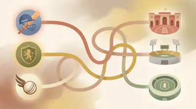
Match IPL teams to home grounds
Test your IPL venue knowledge by matching each team to its home ground. With a mixed difficulty set, you’ll see both obvious stadium-team pairings and trickier updates from recent seasons. Pick your preferred question count and difficulty, then play at your own pace with no timer.

Escape room etiquette and safety rules
Know the unspoken rules of the game before you step into the room. This quiz covers escape room etiquette, safety basics, and smart team behavior—from handling props correctly to what to do in an emergency. Expect a mix of easy reminders and tricky scenarios you might actually face.